The Alps form a major natural barrier that separates Italy from its northern and western neighbors. For more than 2,000 years however, peoples discovered and built ways across these mountains.
The Alps also have among the most spectacular landscapes in Europe. What could be better than exploring Europe’s history in such a setting?
This page shows the most important of these historic routes across the Alps and how they developed through history.
Mountain passes are the natural key points to cross a mountain range as the Alps. Their location and their approaches remain constant through history. This makes it particular interesting to understand how these routes changed over time and to visit them and look for traces of the past.
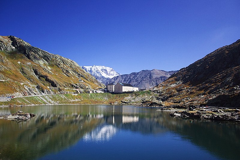
The Brenner Pass is one of the lowest crossings of the main chain of the Alps. This geographical feature attracted travelers and trader early on and the Brenner was part of the Phoenician and Etruscan trade routes across the Alps that are known as Amber Routes.
Roman Roads
When the Romans conquered areas north of the Alps they also needed lines of communication across the mountains into southern Germany.
From Bolzano there were and still are two main routes to choose from:
- West along the Adige valley toward the Reschen Pass. From this pass down into the Inn valley and then across the Fern Pass out of the mountains. – To the Romans this was known as Via Claudia Augusta
- North-east along the Eisack valley toward the Brenner Pass. From there also down into the Inn valley. – To the Romans this was known as Via Raetia
The Romans first built a road over the Reschen Pass at 1,504 m to lead to the provincial capital at Augsburg. It was completed around 50 AD. About 100 years later, the trails leading across the Brenner at 1,370 m were improved into a Roman road as well. At Innsbruck, were it reached the Inn river, it forked to go to the East along the Inn Valley and to the North across the Seefeld Saddle and on to Augsburg. Both routes were used in the Roman Empire. When their rule broke down, road maintenance stopped for centuries and roads fell into disrepair.
Medieval times
Traffic between Italy and Germany continued to be important:
The north Italian kingdom of Lombardy came under Frankish and then German rule and communication with the church in Rome – the most important institution at the time – needed to be maintained.
The lack of road maintenance started to have consequences however. The Eisack Gorge east of Bolzano became more and more impassable. A local detour was established, which included another climb to 1,164 m at Lermoos. With this second mountain pass to cross, the route over the Reschen was preferred by travelers and traders.
The situation only changed, with a rare event of road building during medieval times. A local Bolzano merchant, Heinrich Kunter, was permitted in 1314 by his lord to improve the route through the Eisack Gorge. The Kunter’s Way changed the balance in favor of the Brenner again and around 100 years later 90 % of the traffic between Venice and Augsburg went across the Brenner.
From the 12th century onward, the area around the Brenner and the Reschen Passes consolidated into the county of Tyrol. While it was part of the Habsburg Empire for most of its history, it was split across the watersheds of the Brenner and Reschen Passes after the First World War. Today the northern part is part of Austria and the southern part is part of Italy. Both parts still share language and culture however and as part of the European Union form a cross-border Euroregion.
Modern developments
Traffic across the Brenner continued to be very important and improvements continued throughout the centuries. The railway across the Brenner was the second railway line across the Alps after the Semmeringbahn southwest of Vienna. It was completed in 1867.
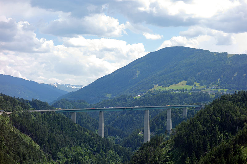
The next major improvement was the Brenner motorway, which was one of the first mountain motorways in the World. It was built in the 1960s and 70s and carries most of the traffic across the Brenner today. The key structure of the Brenner motorway is the Europa Bridge. It was the highest bridge in Europe in the 1960s.
In 2007 work started for the Brenner base tunnel. This 55 km long railway tunnel will greatly improve the capacity and reduce the traffic impact to the local population around the Brenner.


,_Blick_Richtung_Süden.jpg)
To be expanded…
– Herrmann, Schreiber, The History of Roads – From Amber Route to Motorway, Barrie and Rockliff, London, 1961
– Alpine Convention – Report on the State of the Alps – Alpine Signals – Special edition 1 – Transport and Mobility in the Alps – link