Bavay was briefly site of the headquarters of the British army in August 1914, before the great retreat began after the battle of Mons.
The road leading south-west from Bavay towards Le Cateau was used by the retreating forces and the German army following suit. Therefore, following that road gives some idea about the circumstances of those days in the summer of 1914.
The road is straight as an arrow for some 30 km going over rolling hills and through patches of forest and open agricultural areas. There is not much cover for a retreating force and driving along the route is does not come as a surprise, that the British chose Le Cateau as the place for the next fight. Here, where the road crosses a small river and its valley, is a topographical feature the retreating army used to delay their opponents.
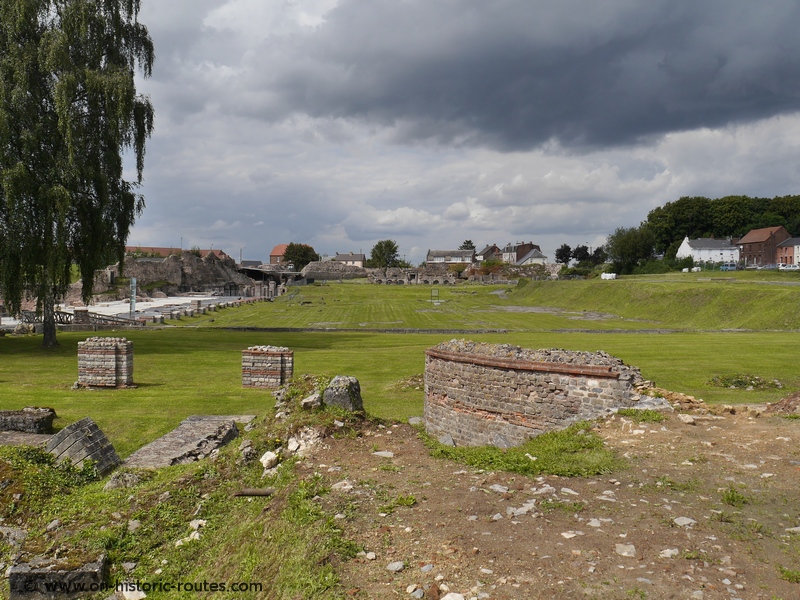
What is remarkable about this road is that it is based on a Roman road as are the six other roads radiating like sunbeams from Bavay. While the knowledge of the roads and its Roman origin was there all the time, only after a bombing raid in the Second World War, the remains of the Roman city were discovered.
Today a big area with the ancient forum is excavated and very close to the town center.
The roads joining in Bavay were coming from Boulogne sur Mer (the Roman port to Britain), Amiens, Reims and Cologne in Germany. The site is evidence of the long lasting impact the Roman road network had and still has on European history.
This post is part of the series “The way to the Western Front”. Explore the full content here..
Share This: