A continental divide or watershed does not have to be a place somewhere high up in the mountains. One of the most important watersheds in North America is near downtown Chicago, Illinois: the Chicago Portage. It is the main reason the third biggest city in the United States was built.
History of the Chicago Portage
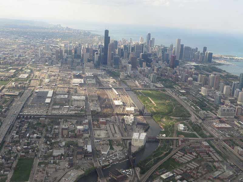
Around Chicago, the drainage basins of the Great Lakes and the Mississippi River system join. The Chicago River is the western part of the Great Lakes basin and the Des Plains River the eastern part of the Mississippi basin. In earlier times, a swampy, occasionally flooded area called Mud Lake of about 13 km lay between them.
The Native Americans used the location for long distance travel and carried their canoes to the other side of Mud Lake to continue their journey. They showed the portage to the French expedition of Louis Joliet and Jacques Marquette in 1673.
The French settlers and voyageurs continued to use it for the fur trade for more than 100 years. It was one of the few routes to travel between the French colonies along the Mississippi and on the Great Lakes.
Immediately after the Louisiana purchase, the United States built a first presence with Fort Dearborn near the mouth of the Chicago River in 1803 and Chicago was incorporated as a town in 1833.
Building Canals along the portage route
The route for a canal along the portage was surveyed in 1824 and the Illinois and Michigan Canal was opened in 1848. Ships could travel directly from the Great Lakes to the Mississippi River through what was Mud Lake before.
The waterway from New York through the Erie Canal, the Great Lakes and the Illinois and Michigan Canal to the Mississippi was crucial for the expansion of the United States in the 19th century. Chicago was the hub along this route. Settlers from the East Coast and grain from the farmland in the West passed through the city, which soon became the second largest in the country.
The Illinois and Michigan Canal was replaced by the bigger Chicago Sanitary and Ship Canal, which is still in use today for shipping. During the construction, the flow of the Chicago River was diverted and today it flows through the Chicago Portage into the Des Plains River.

Heritage of the portage
Much of the old portage has been buried under the growing metropolitan area of Chicago. On the former western end of Mud Lake, there is the Chicago Portage National Historic Site. A monument and a trail through the remaining woodland remember the importance of the location that led to the foundation of Chicago.
On the former eastern side of the portage there is the Canal Origins Park, which offer views on the current waterways.
The portage is also remembered, however more abstract, within the flag of Chicago. The blue stripes in the flag represent the water ways of the city with the bottom one for the south branch of the Chicago river and the canal along the Chicago Portage.
Then sign up for our free email newsletter to get all our new posts right to your inbox.